
This article is related to a series of Geolocation challenges posted on Hacktoria. This article is specific for Geolocation 4.
The challenge is to geolocate the given image.
The screenshot of the challenge is given below:

Let’s try to solve this challenge.
First try to find clues on a given image of geolocation.
As from the picture it is very clear that it might be like a government building or building of high status. There are American flags in front left of the building and there is another flag which is unable to identify and at the center of the roof in front of the doom of the building. The central doom appears to be made of gold. There is a little memorial in front of the building. As the American flags are there around the building it is most probable that the building is located in the USA.

Let’s try to reverse image search.

Almost all of the search results are showing that the building is the Iowa State Capitol.
Let’s try to search for the Iowa state capital and make sure about it.

Search results confirmed that it is the Iowa State Capitol building. As now it is confirmed about the building now let’s try to geolocate this building using Google maps.

If you look at the location closely on the right side of the map there is parking area and there is no memorial in front of the building while on the “State Law Library” side there is a little memorial named “Civil War Mortar” present.
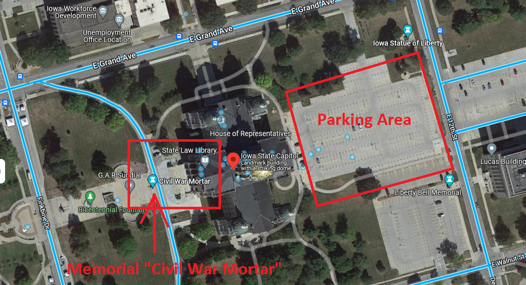
Switch to Street View in Google maps for a more detailed version from the center of the path near most to the Civil War Memorial.

You should have the same view as in the image below. If now then try to rotate the camera of street view.

Zoom this view and you will find out both flag pools of the American and Iowa state flag. In the center there is “Civil War Mortar”.

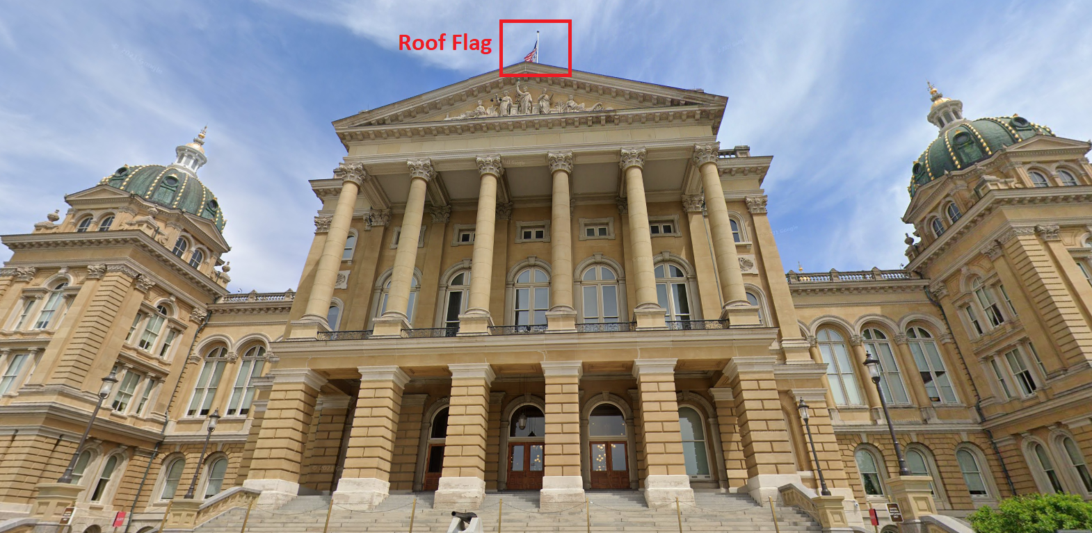
Then rotate the camera to 180 degree and you will see the below given view and the roof flag can be seen.
As the challenge is successfully completed, let’s try to locate the probable place from which the picture is taken. We need to go back to map satellite view to guess.

These are the 2 points from where a given picture might be captured. Take the street view from the first point.

First place is not the place of the photo taken because the photo includes both of the flags on the ground and from this view flags cannot be included in fact flags are behind of this place so we have to verify it from the second place.

Now try from the second street view.

It is more probable that the image is taken from this place or somewhere near around this place. As from this Civil War Mortar seen and both flags are also seen. Try to zoom the view from this place.

Boom! This given image is taken from somewhere near this place.
Coordinates of Iowa State Capitol: 41.59122709296469, -93.6038046349877
Coordinates of the place of Photo Taken: 41.590311245598855, -93.60812704476382
Here the challenge is completed. Kindly share it if you like. Thank you. See you in the next challenge.
